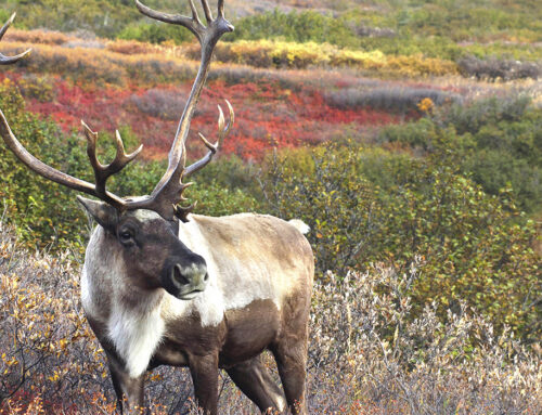
BQCMB TO RELEASE POSITION PAPER NEXT MONTH
With mining activity swelling and a diminished Bathurst herd signalling possible population declines for other herds (Caribou News in Brief, December 2003), the BQCMB plans to release a position paper calling for protection of the Beverly and Qamanirjuaq calving grounds and other important habitats by the end of this summer.
BQCMB members will finalize recommendations for caribou protection throughout the summer and then send the position paper to government ministers, and relevant planning and regulatory agencies, asking for feedback by the end of September. It’s hoped that authorities would start implementing the BQCMB’s recommendations before the 2005 calving period.
Action urgently needed in the Kivalliq
“Something has to start happening soon,” stresses Yellowknife biologist Leslie Wakelyn, who is producing the position paper with BQCMB members. “The way the Kivalliq is potentially going to be developed over the next few years, if they (governments and agencies) don’t start right away, they’re not going to have anything in place before development and not even during development.”
Right now, Starfield Resources is conducting advanced exploration for copper and nickel at Ferguson Lake, an area used by Qamanirjuaq caribou during calving and post-calving. Cumberland Resources’ proposed Meadowbank gold mine north of Baker Lake is near Beverly and Qamanirjuaq traditional calving grounds and post-calving range while the Meliadine gold project north of Rankin Inlet, owned by Cumberland and Comaplex Minerals Corp., is also near Qamanirjuaq calving and post-calving areas.
What’s more, with the exception of the Thelon Wildlife Sanctuary, prospecting permits have been issued across the Kivalliq. Numerous applications for advanced exploration and development may be submitted throughout the Beverly and Qamanirjuaq calving and post-calving ranges over the next several years.
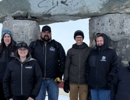
Fort Smith Métis Council president Kenny Hudson (left) and BQCMB member Earl Evans say truck traffic is affecting caribou behaviour.
Development affecting other herds
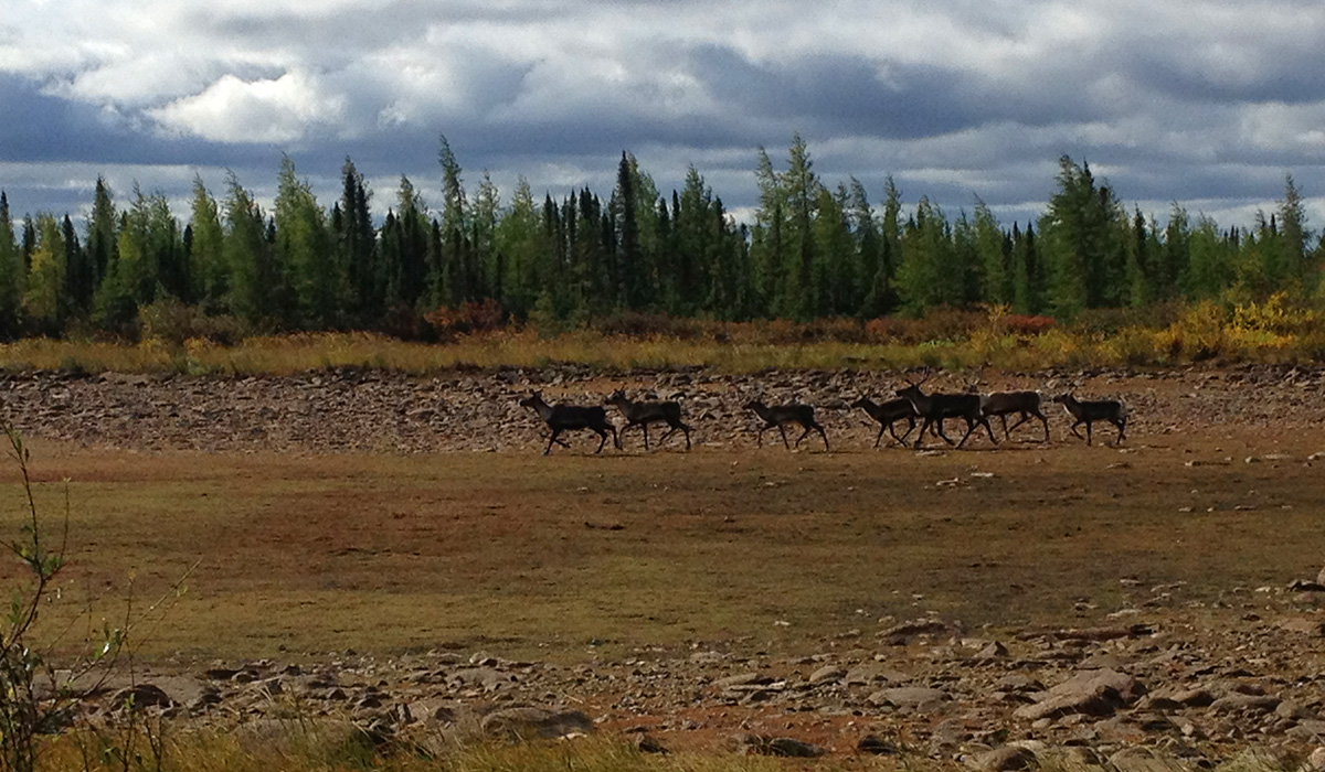
In June, the federal government approved Nunavut’s first diamond mine, Tahera Corporation’s Jericho project in the West Kitikmeot, as well as NWT’s third diamond mine, De Beers’ Snap Lake project. At the BQCMB’s May meeting in Fort Smith, two hunters said they had seen first-hand how human disturbance is changing caribou behaviour.
BQCMB member Earl Evans and Fort Smith Métis Council president Kenny Hudson do a lot of hunting near the old Lupin Mine, where regular convoys of transport trucks travel the Tibbitt to Contwoyto ice road, a joint venture between NWT’s diamond mines and Lupin. “They (the truck drivers) stop there,” says Evans. Most truck drivers are from the South and have never seen caribou before. “They’re not supposed to stop on the ice road with the truck, but they get out on the running board and they’re videotaping and taking pictures.” With noisy trucks scaring them, caribou stay off the big lakes more, notes Evans. Instead, they cross in the bush where wolves attack them.
Janet Robinson of RTL Robinson Enterprises, the truck hauling firm that regulates the drivers, confirms that “stopping is prohibited” unless at pre-arranged camps.
Hudson has noticed that caribou stick mainly to one side of the road, feeding only there. “They really can’t cross the road because there’s so much traffic.” This, at a time when caribou need to fatten up for the long journey north. Hudson says the caribou that are common to this area “are in poor shape because they keep moving all the time. They’re scared away from the road.”
Chris Hanks of BHP Billiton, majority owner of Ekati Diamond Mine, says around 6,000 truck trips were made during the 2004 season between the end of January and April 1st.
The BQCMB has decided such valuable first-hand accounts from hunters could be recorded on pocket-sized observation cards, and plans to evaluate standardizing this sort of reporting system at its November 2004 meeting.
Meanwhile, read the BQCMB’s position paper online at www.arctic-caribou.com in September, and look for more details in the next issue of Caribou News in Brief.
AROUND THE RANGE
Consultations to come on Nunavut/Manitoba road
The consultant who will manage the $1.1-million Nunavut/ Manitoba road route selection study should be hired by mid-July, says Manitoba Transportation director Amar Chadha. That consultant will then organize consultations with northern communities, including Tadoule Lake, Lac Brochet, Brochet, Lynn Lake, South Indian Lake, Gillam, Thompson, Churchill, Baker Lake, Chesterfield Inlet, Rankin Inlet, Whale Cove and Arviat.
The BQCMB will air its thoughts on a possible route during a presentation to government officials at November’s meeting in Winnipeg. If it favours any of the three routes, it would likely be the Churchill-Gillam-Fox Lake path, which would create minimal disturbance. Another major stakeholder is the Hudson Bay Neighbours Regional Round Table, representing the Kivalliq Chamber of Commerce, the seven Kivalliq hamlets, and Churchill, Fox Lake and Gillam in Manitoba. Some communities in the Round Table made it clear at their Feburary 2004 meeting that they share the BQCMB’s viewpoint, while others wished to wait for further details on the feasibility of routes before making an endorsement.
When caribou get the munchies
University of British Columbia PhD in geography candidate Pamela O (her full last name) earned a $1,500 Caribou Management Scholarship Fund award to study the balance of carbon dioxide along spring and fall migratory trails where caribou graze, comparing that to places where caribou don’t forage as often. When any living thing breathes, it gives off carbon dioxide. Plants, meanwhile, absorb carbon dioxide in order to grow. Although carbon dioxide is a natural greenhouse gas, there’s too much of it these days because carbon dioxide also results when fossil fuels are burned. The overload is contributing to global warming. O’s study, taking place around Daring Lake, NWT, will help take a reading of carbon exchange in low Arctic ecosystems – important to understanding the area’s overall carbon balance.
Plans make progress
At the Beverly and Qamanirjuaq’s next meeting in Winnipeg, Board members will ratify text of a new management plan in a short, easy-to-read overview version. Later, the Board will develop links to 17 or more detailed action plans. These guiding documents are the follow-up to the Beverly and Qamanirjuaq Caribou Management Plan 1996 – 2002.
Meanwhile, the Bathurst Caribou Management Planning Committee is finalizing its draft management plan now. The herd, whose range straddles a hotly contested mineral-rich area, saw its estimated numbers drop from 350,000 in 1996 to 186,000 in 2003.
BQCMB meetings
As usual, the BQCMB gathers in Winnipeg for its fall meeting, this year set for Nov. 26 – 28. Board members voted to meet in Rankin Inlet at the end of May 2005 the following spring, and will settle on exact dates at November’s session.
LESS FIRE PROTECTION IN SASKATCHEWAN
Squeezed by tight budgets, Saskatchewan Environment has eliminated a modified fire protection zone in northern Saskatchewan, meaning trappers’ cabins and other structures outside communities may no longer be saved from fire.
While fires are still fought in a 20-kilometre area around communities, the rest of northern Saskatchewan has been dubbed an observation zone where fires are allowed to burn – as they were under the 15-year-old modified protection zone, stresses Daryl Jessop, science and planning section manager of Saskatchewan Environment’s Fire Management and Forest Protection Branch. The government doesn’t compensate for structural losses. It urges people to insure their structures and, with permission, clear away some surrounding trees to allow fires to pass.
The department asserts that allowing fires to run their course is healthy because it creates a patchwork of burns, and “the more patchwork you have, the less wholesale fires you have that run across the landscape,” says Jessop. “Caribou seem to adapt,” although “it would change their migration patterns, for sure.”
That’s a problem for Saskatchewan communities that have to book costly charters in order to find caribou to harvest.
Even NWT residents that hunt the Beverly herd are concerned. “Saskatchewan’s land base is getting decimated by fires and they don’t seem to be fighting them like they should,” says BQCMB member Earl Evans of Fort Smith, whose own community sees few caribou now because of fire burns.
“There’s just slowly less and less range for the caribou to feed in in the winter. It’s a major issue.”
REGIONAL WORKSHOPS UNVEIL MONITORING PRIORITIES
Fond du Lac was to be the scene of the latest BQMCB community workshop that is part of a series of workshops nailing down the most logical caribou monitoring indicators in regions around the ranges.
The goal is to whittle down the 44-page questionnaire plus mapping exercise that was part of the BQCMB’s 2001-2002 caribou monitoring pilot project in Nunavut. The project will also link mapped data from Baker Lake and Arviat hunters with vegetation and/or satellite-collaring data collected on the Qamanirjuaq range by Nunavut’s Department of Environment.
The research, headed by the community liaison for the BQCMB caribou monitoring program, Anne Kendrick, strives as well to methodically create links between traditional and scientific knowledge.
Baker Lake elder Basil Tuluqtuq describes caribou issues of concern in his region
Photo by Anne Kendrick
Regional concerns on video
The Saskatchewan visit to Fond du Lac was slated for mid-July. As with the June workshop in Manitoba’s Lac Brochet and the late April/May workshops in Nunavut in Baker Lake and Arviat, discussions were to be videotaped for a range-wide video.
A fifth workshop in the NWT is still to be decided. The initial plan to stage eight community workshops has been trimmed back. The original $209,000 project estimate was resized to $82,000 plus support-in-kind, with contributions from Indian and Northern Affairs Canada’s Environmental Capacity Development Initiative, the BQCMB, the Nunavut Wildlife Management Board, the University of Manitoba and the Canada Research Chair for Community-Based Resource Management.
In Lac Brochet, BQCMB member Jerome Denechezhe co-chaired the two-day event with Kendrick while Willie Loone translated and Joseph Tssessaze videotaped events. Jack Denechezhe and Simon Denechezhe assisted by helping to set up the premises, notifying elders, and bringing them to the meeting.
Elders there spoke about caribou movements in areas such as the Nueltin Lake and Poorfish Lake, and remarked on the return of caribou to their area this past winter after an absence of many years. The effects of fire on the wintering range is a clear concern for elders.
In Baker Lake, BQCMB member and Hunters and Trappers Organization (HTO) president David Aksawnee took the role of co-chair while Mary Quinangnaq translated and Betsy Aksawnee, a caribou monitor during the BQCMB’s caribou monitoring pilot project in Nunavut, videotaped. In Arviat, Mike Curley – another caribou monitor with the Nunavut pilot project – shared the stage with Kendrick as co-chair while Albert Sulurayok translated and Frank Nutarasungnik videotaped. Nutarasungnik helped Kendrick interview elders in 2003 as part of the BQCMB’s pilot project. “I was pretty happy with it,” says Aksawnee of the workshop. He found the group format encouraged more discussion, “a bit more than having it one-on-one.”
Volatile weather upsets plans
In Baker Lake, people urged that the effects of changing weather on caribou remain a central part of interviews.
“They talked about one winter, the snow conditions may be perfect for traveling, building snow houses, trapping, that sort of the thing,” recalled Kendrick. “The next year, you’ll have such variability, the prevailing winds are different, you can’t really navigate by the lay of the snow, you can’t make proper snow traps for foxes, you can’t rely on your (snow machine), on getting a sense of your bearing.
“And the next year, you may be back to being able to read the land properly.”
In Lac Brochet, elders are anxious to see other workshops include youth, so that they can absorb the elders’ knowledge and provide their own ideas for a future community-based caribou monitoring project. Kendrick says North of 60 land claims staff members may use some results from June’s workshop to support funding proposals for an ongoing community-based caribou monitoring project.
VALUABLE FEEDBACK FROM PROJECT EVALUATION
Cut back on questions and make them shorter, interview elders, women and pilots in addition to hunters, and let people describe generally what they’ve observed on the land, rather than only asking them to answer specific questions.
These are just some improvements recommended by 16 BQCMB members, alternate members and caribou monitors interviewed to evaluate the BQCMB’s community-based caribou monitoring project – a two-year pilot project conducted with the HTOs in Baker Lake and Arviat. Beyond the improvements cited was strong support to expand the program to other communities across the Beverly and Qamanirjuaq caribou ranges.
The final evaluation report, still in progress, will also present recommendations from caribou monitoring program co-ordinator Leslie Wakelyn and community liaison Anne Kendrick. Kendrick will make further recommendations based on her ongoing research later (see “Regional workshops unveil monitoring priorities”).
The caribou monitoring program’s goal has been to create a long-term monitoring system that uses local/traditional knowledge collected through community-based monitoring as well as information collected by government and scientists. It was not to replace science, a misconception that surfaced in some evaluation interviews, notes Wakelyn.
NEW, IMPROVED COLLARS WEIGH LESS, WORK BETTER
A new generation of satellite collars placed on 10 Qamanirjuaq cows this spring record much more accurate locations, last longer and hang more comfortably around caribou necks since the collars weigh a third less than the older ST-14 model.
These new Global Positioning System (GPS) collars reveal locations accurate to 10 metres or less – not half a kilometre away, like the worst readings of older collars. And since the new collars are turned on and reporting in to satellites only once every eight days for a single hour – instead of being on for five to seven hours once every four days – the new version uses less power and now lasts three years.
Weighing in at 900 grams or less than two pounds, “the GPS collars affect (caribou) a lot less, and some caribou have carried those ST-14s, which are bigger and heavier and bulkier with wider straps, for three, four years without any apparent incident except a lot of matting around the neck,” notes Arviat biologist Mitch Campbell. “There’s no scarring or removal of tissue or blood or anything like that.”
Beacon delivers the details
The collars collect signals daily for eight days in a row from a dozen satellites circling the Earth overhead. Based on these signals, the GPS calculates a precise latitude and longitude. These details – stored in the collar’s satellite beacon, another new feature – are downloaded from the collar to a satellite through a satellite signal, and sent to a ground station in the United States that deciphers the data and e-mails the caribou locations for the past eight days to biologists.
A few females from the Qamanirjuaq herd have sported collars since 1993. Dene elders in northern Saskatchewan oppose the use of satellite collars on Beverly caribou. Still, BQCMB alternate member Pierre Robillard pledged at the Board’s May meeting to try to obtain resolutions of support from bands in northern Saskatchewan.
Satellite collars function through the Argos satellite system, a joint France/U.S. endeavour. To attach collars to Qamanirjuaq caribou, a net gun is shot from a helicopter to capture a cow. The net is then pulled off and the animal quickly collared and released. No drugs are used. Caribou are blindfolded to relieve stress, and their heart rate monitored to ensure it goes down to normal levels.
Noise from helicopters disturbs caribou most in the collaring process, so helicopter engines are either turned off if the weather is warm enough to safely do so without risking the engine freezing, or pilots fly a short distance away.
Second line of evidence
Biologists find location data from satellite collars provides powerful proof showing where calving grounds are situated. “It gives you a second line of evidence that you’ve done (a population) survey correctly,” says NWT caribou biologist Anne Gunn.
As important as physical improvements to satellite collars are, Gunn points out that the ability to better exploit the location data through more sophisticated Geographic Information System (GIS) and mapping techniques is just as groundbreaking.
ARE SATELLITE COLLARS THE ONLY ANSWER?
BQCMB member Joe Kaludjak: can surveys be done without satellite collars?
When it comes to doing effective surveys, no. But the alternative – increased sampling effort and flying time – is costlier.
While satellite collars make the job of surveying caribou herds far more efficient, interviews with select biologists across Canada reveal it is possible to survey caribou herds without collars if more sampling work is done. That means more expensive flying time to locate caribou, adding to the current estimated $150,000 cost of staging a survey.
Biologists disagree, however, which type of survey works best without collars.
The search for alternatives stems from an impasse over satellite collaring that has bedevilled management of the Beverly caribou herd for several years. The herd, estimated to number 276,000, was last surveyed in 1994, as was the much larger Qamanirjuaq herd. The BQCMB’s Beverly and Qamanirjuaq Caribou Management Plan, 1996 – 2002 recommended population surveys be done every six years.
BQCMB community representatives have been calling for population counts since surveys of the Beverly and Qamanirjuaq herds became overdue in 2000. The range of the Beverly herd covers a lot of ground: from Great Slave Lake, Northwest Territories (NWT) to east of Dubawnt Lake, Nunavut, and from Slave River in Alberta across northern Saskatchewan to near Nueltin Lake in Manitoba. According to the BQCMB’s harvest calculation formula, the Beverly herd is thought to be close to or past its sustainable harvest limit.
The Athabasca Seasonal Road from Points North to Fond du Lac, which opened in late 1999, connects northern Saskatchewan with the rest of the province. It also affords treaty hunters from southern Saskatchewan access to the Beverly herd. And scientists suspect caribou from the Bathurst, Qamanirjuaq and Ahiak herds are creeping into the Beverly range, competing for food in an area ravaged by forest fires.
Without current population estimates, the BQCMB won’t recommend new harvest quotas for either the Beverly or Qamanirjuaq herd.
Saskatchewan Dene elders oppose collaring
Location data from satellite collars helps biologists understand the herd’s migration patterns, and provides strong evidence to show where calving grounds are situated. Usually, a very small number of caribou, sometimes as few as 10 or 20 animals out of an entire herd, wears the collars.
In 2002, the government of Nunavut asked the BQCMB to develop new guidelines for using calving ground surveys – among them, having satellite collars placed around the necks of a small number of caribou in order to locate the herd’s calving grounds during the short June birthing season. (The traditional calving grounds and post-calving areas of the Beverly herd stretch from Nunavut to NWT.) Biologists associated with the BQCMB have said that without collaring caribou, survey results can’t be trusted because surveys may be missing large concentrations of caribou.
Yet Dene elders in northern Saskatchewan oppose the satellite collaring of Beverly caribou because they feel it is disrespectful, and fear collars may harm the animal. Others worry the caribou may not return. BQCMB alternate members Pierre Robillard and Joe Martin have said that many elders oppose satellite collaring because several hundred years ago, caribou didn’t return to the Athabasca region after some people tied straps onto the antlers of certain caribou as they began their spring journey north (Caribou News in Brief, August 2003).
The impasse over satellite collaring begs the question: are there any viable ways to follow caribou other than by satellite collar? And as BQCMB member Joe Kaludjak asked at the BQCMB’s May 2004 meeting, is there any way to survey a herd without satellite collars?
Collar-less surveys possible, but what kind?
Former BQCMB member and Canadian Wildlife Service biologist Don Thomas says that in his report Monitoring and Research Needs for the Beverly and Qamanirjuaq Herds of Caribou, 1997 through 2002, he suggested “radio collars were preferred but not essential when caribou were photographically counted in large aggregations, which occur in July of most years. While large aggregations are photographed from one aircraft, other aircraft must systematically search a large area to count small groups that are missed by the photo plane.
“In 1978, after conducting reconnaissance surveys,” recalls Thomas, “we were quite certain that most of the Beverly herd was contained in about 20 aggregations north of the Thelon River.”
However, NWT ungulate biologist Anne Gunn strongly disagrees that post-calving photographic surveys can be done without collars, due to the possibility of missing aggregations. “It’s a risky proposition,” she says, “especially if there’s been a long interval between counts, because you could miss aggregations and you’ll never know it.”
On the other hand, “We could do a calving ground census without satellite collars. It would cost more because we’d have to do more flying.” The key to achieving acceptably precise results is “to put enough effort into ensuring that we take the photos were the most caribou are.”
Percentage of satellite-collared caribou in herds
George River Herd: .005% (20 collars on a population estimated at 440,000)
Western Arctic Herd: .02% (100 collars on a population estimated at 490,000)
Qamanirjuaq Herd: .002% (10 collars on a population estimated at 496,000)
A post-calving survey estimates the total population (females and males of all ages) while a calving ground survey best estimates the productive female component of the herd. Wide confidence intervals of calving ground surveys have come under criticism in the past. For example, the Beverly herd was last estimated to number 276,000 – give or take 189,000. In a worst case scenario, that would put the herd at just 87,000.
Gunn, however, says that a workshop with statisticians and representatives from the governments of NWT and Nunavut several years ago addressed this problem. “We worked with the statisticians and we came up with the means of overcoming (wide confidence intervals).”
Senior wildlife biologist Doug Heard, with British Columbia’s Ministry of Water, Land and Air Protection, says that while the accuracy of both post-calving and calving ground surveys are related to the amount of aircraft time available, “locating animals during the post-calving period is more difficult because the animals are in much larger groups, the groups are more widely dispersed and the animals move much more quickly.
“Finding post-calving caribou will require many, many, many more aircraft hours than at calving time,” says Heard. Regardless of the type of survey, the absence of collared caribou “can be compensated for with an appropriate sampling plan (to measure success at finding caribou) and sufficient aircraft time.”
Other tracking techniques faulty
As for tracking caribou other than with collars, “the problem is that there just aren’t a lot of alternatives that don’t involve handling of animals,” says caribou biologist Mike Ferguson of Nunavut’s Department of Environment. Ferguson, based in Pond Inlet on north Baffin Island, is familiar with opposition to satellite collaring. The views of Dene elders in northern Saskatchewan, he says, are “very similar to the more traditional Inuit who in general oppose any sort of harassment, as they consider it, of most wildlife.”
“Generally, live handling of any animal that you don’t intend to kill is often against traditional Inuit beliefs,” says Ferguson. Nonetheless, satellite collaring of the South Baffin caribou herd went ahead between 1987 and 1995 with the support of communities. “The communities (had) to grapple with this conflict between getting the information that managers need and that many of the Inuit themselves want vs. the violations of these traditional beliefs.”
Other tracking methods used in the past have proved faulty. Ear tagging, says Ferguson, only provides two points of reference – the tagging location and the kill location.
A tagging project of several thousand caribou that began in northern Manitoba in 1959 (extending into the NWT a year later) used different colours of ribbon to identify different herds, says Thomas, who was part of the tagging effort. But tags were hard to see from planes. Residents of northern Saskatchewan also opposed tagging of caribou.
Flying over caribou and spray-painting them – a tactic used to mark Peary caribou on the Queen Elizabeth Islands in 1972 – works only until the animals moult.
Traditional methods of finding caribou
BQCMB member David Aksawnee of Baker Lake says that when Inuit lived out on the land all the time, they knew the herd’s migration routes intimately and would travel to places where caribou were plentiful.
“They used to go and wait in the area where they think the caribou herd is going to get through,” says Aksawnee. “Apparently, in those days, the caribou herd used to go two to three days non-stop.”
August Enzoe, a BQCMB member from Lutselk’e, says weather conditions would tell elders where the caribou were. For example, mid-August always brings damp, cold weather with temperatures of only two or three degrees Celsius, says Enzoe. “When the weather is like that, the whole time the caribou hid in the bush,” says Enzoe. “We have that every August, and a week later, it warm up again.”
Joe Tetlichi of Whitehorse says that according to some Gwich’in who hunted a long time ago, there were certain places the caribou visited on their winter habitat every year without fail, regardless of the weather. The reasons for this were unknown.
Living on the land resulted in a special bond with the caribou. “Our people used to be very spiritual and very connected to the caribou, “says Tetlichi, who is chairman of the Porcupine Caribou Management Board. “A lot of times, I remember even my grandmother, elders like her, way back in the ’50s and ’60s when we were growing up, they would dream about caribou.
“Through their dreams, they knew where they were.”
Collaring on rivers best
Collars have evolved over the years. Radio collars (also called VHF collars) were first used in the 1950s. Scientists had to monitor wildlife by aircraft in order to detect the radio signal these collars emitted. They’re still used when a cheaper, less sophisticated alternative to satellite collars will suffice.
In the late 1970s, the Argos Data Collection and Location System twinned satellites orbitting the Earth with computers to examine migration timing, routes, and stopovers with greater frequency and resolution. Microprocessors in collars sent signals to satellites. These signals were monitored by a data location system and sent to a processing centre that ultimately relayed information over phone lines to scientists’ computers.
With the 1990s came energy-efficient GPS systems that made it possible to store locational data within the collar.
Biologist Jim Dau of the Alaska Department of Fish and Game stresses that it’s important to collar animals in ways that are most acceptable to users. The Western Arctic Herd has worn satellite collars since the late 1980s, and collars are attached only during river crossings – a quick three- or four-minute procedure that doesn’t involve any noisy helicopters, net guns or drugs.
Collaring practices vary from one district to another, but the fewer times an animal is handled, the better. When a caribou in the Western Arctic Herd is collared, “that caribou has the collar the rest of its life,” says Dau. Caribou can’t be found without using a helicopter, and the risks of recapturing an animal using a helicopter and dart or net gun, according to Dau, are no less than living with the collar.
Dau, like biologist Donald Jean with Quebec’s Société de la faune et des parcs, finds batteries currently last about six years. However, caribou in the herds that Jean helps manage, the George River and Leaf River herds, are recaptured and recollared once in order to gather individual history that spans much of the caribou’s average 15-year life.
In Alaska, satellite collars are deployed on most herds except the Western Arctic Herd using helicopters and dart or net guns, with the caribou being recaptured every three years and given a new collar. In Nunavut, where helicopters and net guns have traditionally been used, collars on Qamanirjuaq cows are now programmed to drop off on their own after three years.
Involve communities in collaring
When satellite collars were first used on Porcupine caribou, “people were really opposed,” recalls Tetlichi. They worried that the collars were too heavy, that they would rub uncomfortably on the caribou’s skin, that other caribou wouldn’t approach a collared animal. “They were thinking of all kinds of negative reasons.”
As a result, “one of the things that we really try to implement through the Porcupine Caribou Management Board is communication and a strong relationship with the community,” says Tetlichi. “Education is very important. If people don’t know what’s happening, then they’re going to oppose it.”
Having only 10 satellite-collared animals in a herd of 123,000 is a small dent in the population, Tetlichi constantly stresses. “With these 10 caribou, we get a lot of information and that’s what we try to express to the communities.”
Every year in Alaska, “we have a couple of schools that come out, local kids and teachers,” says Dau. “They go home and they tell their parents what we’re doing and, more importantly, why we’re doing it.” At camp, an open-door policy means people hunting on the river could join Dau’s team to see what is happening.
Vince Crichton, a senior scientist with Manitoba Conservation’s wildlife and ecosystem protection branch, says the best way to introduce the topic of collaring is to demonstrate how the collars work.
“Bring a receiver out. Bring a transmitter out,” urges Crichton, who also sells collars for industry leader Telonics. “Demonstrate how the mortality sensor goes off and show them. Let them feel and look at it . . . what the automatic release mechanism looks like. Do some demonstrations in the field. Somebody go and hide (a transmitter) on a tree and then give them a receiver (so they can go and find it).”
Expertise of hunters
Just as important as getting location data from collars is talking to local residents to “add to what we know about distribution from the collars,” says Dau.
Tetlichi agrees that the combined knowledge of scientists and hunters is the best educational approach. However, it wasn’t until 1990 that traditional knowledge’s validity was acknowledged. “‘You also have to respect us,'” Tetlichi and others told members of the scientific community. “‘We are experts, too. We’ve followed the caribou. We lived with the caribou. We know a lot about caribou that you don’t know.”
For the 490,000-strong Western Arctic Herd, “you can have literally thousands and thousands of caribou in some area where there’s no . . . collars just because of the dilution effect,” says Dau. Subsistence hunters in his region harvest about 10,000 caribou annually, and Dau says they have exceptional insight into body condition.
While the Western Arctic Herd collars a tiny .02 per cent of the population, Dau says up to 20 per cent of some very small Alaskan herds are collared – a distressing sight to local residents.
“I’ve said for years that there ought to be more limits on what we as biologists do than just what we can afford. Often what I see is, somebody gets a big chunk of money, they get research funds to do some big project and they spend it all.
“They put as many collars out as they can, they fly as many possible surveys as they can. Sometimes it seems excessive.” Dau finds the desire to get published in highly regarded scientific journals is often the reason for the excess.
Nothing beats collars in some cases
While population surveys can be done without satellite collars if more money is invested in sampling work, biologists underline that satellite collars are beyond compare when it comes to gathering certain types of caribou management information.
“If you want to develop baseline (data) to deal with environmental assessments, then you need collars,” says Gunn. “If you want to know the effect of distribution of forest fires, or snow conditions, then there’s not really an effective substitute” to collars.
In Quebec, “we use collars and collars and collars and nothing else,” says Jean. Collars are useful for determining mortality rates, for tracking caribou in the fall, and for classification of calves per cows. “With all those informations, you can have pretty good population simulation models,” says Jean. “I think the satellite information is essential.”
FUN IN FORT SMITH
In May, the BQCMB convened in Fort Smith by the Slave River. The Radium King tugboat (left at top), located beside the community recreation centre, commemorates the town’s river heritage.
With the Thebacha Campus of Aurora College and a large high school and elementary school, education is a defining presence in Fort Smith today.
During an assembly at Joseph Burr Tyrrell Elementary School, Grade 2 student Michelle Mabbitt displayed some sure-footed skipping (top right) while colleagues looked on (below).
The BQCMB’s stay in Fort Smith was capped off with a lavish outdoor feast. BQCMB secretary-treasurer Ross Thompson, members Joe Kaludjak and David Aksawnee, and alternate Pierre Robillard share some laughs (bottom photo).
GETTING READY TO MEET THE FUTURE
Every June, new calves replenish the herds and keep the group strong by injecting new blood. It’s a natural life cycle. The BQCMB, taking a cue from the caribou, will soon investigate a project and potential partners in order to bring one or more youth representatives into the fold. This way, the 23-year-old Board can continue to provide vital caribou management advice for years to come.
With all the work before the Board – setting up community-based caribou monitoring systems in the face of escalating mineral exploration and potential road developments is just one example – it’s important to involve young up-and-coming hunters and wildlife managers who can some day step into the shoes of long-time Board members.
In preparing for the future, the BQCMB will also review a proposal for marketing and fundraising strategies at its November meeting. Such tactics would help the Board build on partnerships, spread the word about the BQCMB’s achievements and ongoing goals, strengthen financial resources and make sure government agencies and others recognize the Board’s value. With a mandate renewed until 2012 by the governments of Manitoba, Saskatchewan, the Northwest Territories, Nunavut and Canada, the BQCMB wants to get a headstart on its future.
PEOPLE AND CARIBOU
Even mosquitoes were scarce during a fine barbecue held for the BQCMB at the home of Richard Mercredi (inset)
Duck, moose, caribou, buffalo – that’s not just a description of the wildlife around Fort Smith. It’s a small portion of a bountiful feast staged for BQCMB members at the conclusion of their May meeting. Gracious hosts Richard Mercredi, a former BQCMB member, and wife Barb opened up their home and back yard to Board members, with hosting duties shared by BQCMB member Earl Evans, Fort Smith Métis Council president Kenny Hudson and wife Cathy. Mod Casaway, who was representing Lutselk’e in Board member August Enzoe’s absence, expertly flipped steaks at the grill, and Fort Smith’s Sam Ransom, a former NWT and Manitoba wildlife manager, made a too-brief appearance to rekindle some old friendships and crack a few jokes. Everyone dug in to bannock, pickerel cheeks, duck soup, caribou, corn on the cob, moose, potato salad, buffalo and, at meal’s end, a refreshing strawberry shortcake.
BQCMB chairman Jimmy Laban was unable to attend May’s meeting, so vice-chairman Tim Trottier took the helm while secretary-treasurer Ross Thompson acted as the meeting’s facilitator. Saskatchewan alternate member Pierre Robillard made the trek to Fort Smith, as did Willie John Laurent of Fond du Lac. There were no members from Manitoba, however.
A key behind-the-scenes player in the BQCMB’s caribou monitoring pilot project has been the Canadian Wildlife Service’s Joan Eamer of Whitehorse. Using data supplied by program co-ordinator Leslie Wakelyn, Eamer created the reporting web site www.taiga.net/bq, which features indicators such as the time of break-up and freeze-up and levels of human activity to publicize changing trends on the caribou range. Eamer also helped with project design, the caribou monitoring database, and the evaluation. In thanks, BQCMB members presented Eamer with a copy of author Ellen Bielawski’s Rogue Diamonds: The Rush for Northern Riches on Dene Land, recounting the agreement negotiated to minimize negative impacts from diamond mining on the Dene of Lutselk’e.
Nunavut’s territorial elections earlier this year saw two new departments, the Department of Environment and the Department of Economic Development, replace the former Department of Sustainable Development (DSD). Former DSD Minister Olayuk Akesuk is the Minister of Environment. The new Economic Development minister is Baker Lake’s David Simailak.