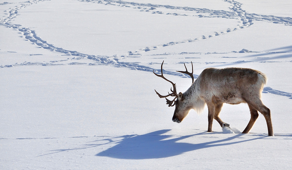
CARIBOU MONITORING STARTS WITH NUNAVUT HUNTERS
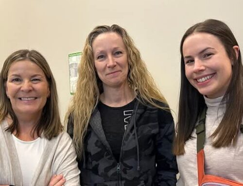
Thirty-six hunters from Baker Lake and Arviat were interviewed during the first phase of the BQCMB’s Caribou Monitoring Project in October-November 2001. Ranging in age from their early 20s to late 70s, those interviewed were active hunters who had been hunting since their childhood or teenage years. These hunters were interviewed because they are considered to be “local experts” on the areas in which they live and hunt, with much knowledge of caribou, conditions on the land and water, and changes occurring as a result of climate change and industrial development.
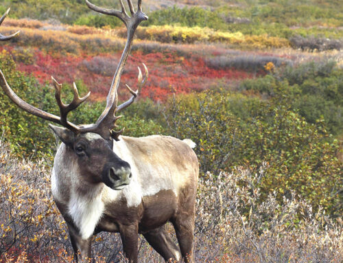
The hunters revealed that many caribou were found close to both communities during the 2001 spring migration, that caribou migrated close to Arviat but not to Baker Lake in the fall, and that animals observed or harvested were generally in good health, although some caribou were limping and others had unusual conditions, such as swollen feet and damaged leg joints. They also noticed many changes related to weather conditions, and reported that ice break-up arrived earlier and freeze-up took hold later in both communities in 2001 than in most previous years.
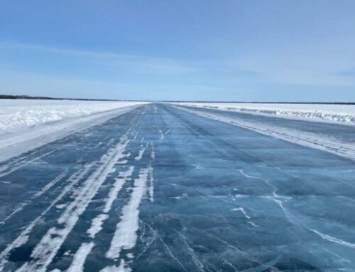
“In spring, some people could not get to the caribou because there was no snow for the skidoos,” noted Baker Lake caribou monitor BQCMB Sarah Silou. “The community of Baker Lake used to be able to use the lake ice right up to the very last day before break-up but this year, people could not use it as it was unreliable and dangerous.”
“The hunters noticed that there were lower water levels of lakes and rivers in the Arviat area,” said Arviat caribou monitor Mike Curley of last year’s dry, warm weather. “In some areas you could see dried-up lakes and streams.”
Silou and Curley are working with their local HTOs and the BQCMB to interview active hunters from their communities, and have started the Nunavut portion of the community-based caribou monitoring program. In 1999, the BQCMB agreed a community-based monitoring system was needed to provide local and traditional knowledge, given the onset of climate change and the effects of man-made developments like mines and roads. It is also needed to complement the science-based monitoring that is undertaken by the many agencies across the ranges of the herds. People need to share knowledge and discuss the impact of change on land, caribou, and people who depend on caribou.
Silou and Curley conducted interviews using a questionnaire developed by Yellowknife biologist Leslie Wakelyn (the project’s co-ordinator) and Gary Kofinas (also with the community-based monitoring program of the Arctic Borderlands Ecological Knowledge Cooperative). The two monitors worked with Kofinas and Wakelyn to refine the interview process and receive training as well. The questionnaire is based on a similar one used to interview hunters of Porcupine caribou in Canada and Alaska. The interview focuses on caribou body condition, distribution and movement of animals, unusual observations, weather conditions that may impact caribou and caribou hunting, and local perceptions of human activities affecting caribou. Maps were used during the interview to record hunters’ observations and other information, such as the areas where hunters travelled during the spring-to-fall 2001 reporting period.
Round two of interviews this spring
Armed with funding from the Nunavut Wildlife Management Board, Environment Canada’s Northern Ecosystem Initiative, and the BQCMB, the long-term caribou monitoring program is planning a second round of interviews in March/April. Round two will focus on the winter season and include work with Baker Lake elders on historical aspects of caribou. After that, Wakelyn, in cooperation with Kofinas, will work with communities and the BQCMB to finetune the program where necessary.
Curley and Silou, who reported their preliminary findings to the BQCMB at the board’s November 2001 meeting, passed on some interesting observations. Caribou appear less afraid now than they used to be, some hunters disclosed to Silou. “Before, the hunters had to even watch where they step, so it won’t change the migration route, the tracks and so on. But now they’re saying that even the skidoos . . . or airplanes don’t seem to bother the caribou too much.”
Several human factors seem to be altering migration routes, too: the presence of cabins, sports hunters, and even uneducated young hunters from the communities.
Years ago, hunters would “never kill the first (caribou) that came through,” says Silou, who heard this repeatedly in interviews. “Because you change the migration routes if you kill off the leaders.”
Hunters yearned for the return of another traditional practice – consulting elders for their advice before embarking on a hunt. “It sounded like it was more organized before,” Silou relates. “Certain people knew how much to catch, how much to kill, how much to bury, like for cache.”
Spreading the word about monitoring
Last August, Wakelyn spoke about the BQCMB’s long-term monitoring project at the Dene Gathering held in Wollaston Lake, Saskatchewan. She’d been invited to attend by BQCMB member Jimmy Laban of Black Lake.
At this point, though, Saskatchewan caribou-range communities haven’t formally asked to participate in the monitoring project. Nor has Lutselk’e in NWT, although the Lutselk’e Wildlife Lands and Environment Committee previously expressed interest in the project.
After the first round of Nunavut interviews, hunters in Baker Lake and Arviat are enthusiastic supporters. All hunters interviewed indicated that they would like to see the program continue, and that they would like elders to be interviewed as well.
“They’re very, very keenly interested . . . and want to be part of the monitoring,” says Silou.
“If ever any major catastrophe happen to them, the caribou, (hunters are) afraid for their food.”
AROUND THE RANGE
Staying in the loop on permitting
In 1993, BQCMB members expressed concern about roads, mines and other developments on the Beverly and Qamanirjuaq caribou range where there had been little or no consultations with either the board or communities.
An understanding was quickly reached with the governments of Canada, Manitoba, Saskatchewan and the Northwest Territories to let the board comment on all proposals on the range that might affect caribou, their habitat, or hunters pursuing traditional activities.
In later years, the Nunavut Impact Review Board (NIRB) and the Mackenzie Valley Land and Water Board (MVLWB) took on responsibility for screening land use applications in Nunavut and much of the Mackenzie Valley district of the Northwest Territories, respectively. While in Yellowknife in November 2001, the executive directors of the NIRB and the MVLWB discussed their mandates with the BQCMB, how the BQCMB would be kept informed, how to participate in reviews, and the responsibilities of regional biologists serving on the BQCMB. NIRB executive director Stephanie Briscoe said that NIRB would like to work with the Nunavut Planning Commission (NPC) and Nunavut Tunngavik Incorporated to use BQCMB caribou range mapping information.
Contacted later by Caribou News in Brief, Michèle Bertol, NPC’s manager of policy and government relations, agreed. “At NPC, we’re not caribou experts. So we rely on organizations like the BQCMB in providing such information. And the type of work they do is very excellent.”
All-weather Athabasca Road?
The results of a new study looking at beefing up the Athabasca winter road from Points North to Fond du Lac to an all-weather road are due out in the spring of 2002. The $125,000 study, sponsored by Saskatchewan Highways and Transportation, Indian and Northern Affairs Canada, Saskatchewan Northern Affairs, and Cigar Lake Mining Corporation, will also examine the cost benefits of the existing seasonal road, plus the potential cost benefits of a road into Wollaston Lake.
BQCMB meeting
Board members head to Baker Lake for the upcoming spring meeting to be held May 3 -5, 2002. After that, it’s off to Winnipeg for the Nov. 22 – 24, 2002 fall meeting. As always, meetings are open to the public.
BQCMB KEEPS PUSHING FOR 2002 SURVEY OF BEVERLY HERD
RWED’s Ray Case
The governments of the Northwest Territories (NWT) and Saskatchewan have promised to contribute to an overdue survey of the Beverly herd in summer 2002, but others will have to help foot the bill before the $160,000 undertaking can go ahead.
Surveying efforts have now shifted to the Beverly herd because of fears that the herd is close to its sustainable harvest limit – if it hasn’t already surpassed it. The new Athabasca Seasonal Road running from Points North to Fond du Lac has made it easier for treaty hunters from southern Saskatchewan to get to the Beverly herd. BQCMB member Jimmy Laban told others at the board’s November 2001 meeting that with 72 First Nations bands in Saskatchewan, the Denesuline feared more pressure would be placed on the possibly already overhunted Beverly caribou. What’s more, BQCMB member Cam Elliott said that by using the BQCMB’s harvest calculation formula, the current harvest of the Beverly herd was very close to the limit.
“I can say now that the GNWT is prepared to . . . provide funding towards a Beverly survey in 2002,” manager of technical support Ray Case, of NWT’s Department of Resources, Wildlife and Economic Development, fisheries and wildlife division, told Caribou News in Brief. He emphasized that his government does not want to bear the entire cost, though.
As of Caribou News in Brief’s deadline, no funding had been announced by the government of Nunavut. The calving grounds of the Beverly caribou fall largely inside Nunavut’s boundaries.
Nunavut wants evidence first
At the same November 2001 meeting, Stephen Atkinson, director of wildlife and environmental protection for Nunavut’s Department of Sustainable Development (DSD), reiterated his government’s position that it would not fund calving ground surveys for either the Beverly or Qamanirjuaq herds without evidence of declining populations or harvest exceeding sustainable limits (see Caribou News in Brief, August 2001). The last survey figures from 1994 were unreliable because of the large confidence limits, Atkinson pointed out. Results of the Beverly survey, for example, could be out by 100,000 – the official 276,000 head count could be as low as 176,000 or as high as 376,000. Until better ways of counting caribou are found, Atkinson suggested community residents may be better able to pick up on population changes than surveys.
The BQCMB’s Caribou Management Plan – endorsed by governments – calls for population surveys every six years, a pro-active plan presently supported by the governments of NWT, Saskatchewan and Manitoba. Without current estimates of population size and trend, the BQCMB can’t provide governments with sound advice on how to manage caribou herds and habitat.
The Nunavut government’s criteria for population surveys, however, are reactive: a change, or perceived change, in caribou population would justify a survey. This means, however, that by the time local observations on a range-wide basis show the population is dropping, a survey would be too late to use for herd management.
Saskatchewan hunters take most Beverly caribou
The BQCMB has asked the Nunavut Wildlife Management Board (NWMB) to help fund a Beverly herd survey. An initial NWMB response asked for stronger justification for a survey.
“The division of funding between the regions is also a concern,” the NWMB continued in its letter dated Dec. 27. Money sought from Nunavut was twice the amount requested from Saskatchewan or NWT. “Based on estimates in a recent BQCMB Annual Report, Nunavut harvests only approximately 9% of the total harvest from this herd.”
According to 1994/95 harvest figures – the most recent available for Saskatchewan communities – Saskatchewan hunters kill more Beverly caribou than NWT, Nunavut and Manitoba hunters combined. Counting the Qamanirjuaq Nunavut’s government is striving for more accurate ways to count caribou. A DSD pilot study done on the Qamanirjuaq caribou in July 2001 used satellite collars to locate groups of post-calving caribou, which were then photographed and counted later. Meanwhile, the government of Manitoba, which had earmarked $50,000 for a calving ground survey of the Qamanirjuaq in 2001, has carried the money over to 2002.
Without current population estimates, the BQCMB won’t recommend new harvest quotas for either the Beverly or Qamanirjuaq herds. Based on the board’s allocation model, there aren’t enough available Qamanirjuaq animals to fill commercial harvest requests from Nunavut communities and Manitoba outfitters and lodges.
ATHABASCA ROAD BRINGS SOUTHERN HUNTERS, AND ALARM
One thing worries the Athabasca Land Use Interim Advisory Panel more than anything else – the risk of Beverly caribou migrating near the new Athabasca Seasonal Road. The road has opened up the remote area to southern hunters with treaty and Metis rights.
The panel, formed in early 2001 to hammer out a land use plan for the region surrounding the Athabasca Road, aims to publish a final land use plan by March 2003. Panel members come from the Prince Albert Grand Council (PAGC) communities of Black Lake, Fond du Lac, Stony Rapids, Hatchet Lake, Camsell Portage and Uranium City.
The land use plan, a tool to better manage the Athabasca region’s fish, wildlife and land resources, will be drawn up in three stages. Stage one covers the most critical area, the 25-kilometre corridor along both sides of the road from Points North to Fond du Lac.
Draft proposal on non-traditional hunters
In mid-November, the panel staged a southern hunters workshop in Prince Albert, and met with BQCMB members Jimmy Laban, Billy Shott and Tim Trottier, along with a member of the Federation of Saskatchewan Indian Nations, and others.
Distinguishing between traditional and occasional users of the caribou resource will be a sensitive task. In the early 1900s, Beverly caribou migrated further south. Some aboriginal people who now live off the range still lived a nomadic lifestyle at that time. In their search for caribou, they would travel to Wollaston Lake and north up the Cree River towards Black Lake.
The panel has asked the BQCMB to help investigate the potential impact of the influx of southern hunters on the Beverly herd by consulting with the Peter Ballantyne Cree Nation, Lac La Ronge Indian Band, Peter Albert Grand Council, the Prince Albert Grand Council (PAGC) vice-chief of the Athabasca Region, the Métis Nation of Saskatchewan, the Meadow Lake Tribal Council, and New North, an association of northern communities that lobbies for development, employment, training and other benefits for residents.
Trottier later sent SERM and PAGC a proposal on this initiative, suggesting that “myself and the other (BQCMB) board members” could contact off-range communities. “Then I invited representation from the Athabasca Land Use panel.” The proposal will next be reviewed by the panel to determine who takes part.
CHAIRMAN SPEAKS AT NATIVE CONFERENCE IN ARIZONA
BQCMB chairman David Kritterdlik
The landscape could hardly be more different: from the snow-covered tundra of Canada’s North to the arid deserts of Arizona. But BQCMB chairman David Kritterdlik, who was invited to speak on wildlife management agreements at an international aboriginal conference in Tucson, Arizona in December, has discovered that while geography differs for native peoples, there is one thing that doesn’t.
“Wherever you go, the native aboriginal people seem to be the ones struggling to have their say in their government,” says Kritterdlik. “(They’re the) ‘underdog.’ ”
This is the fifth conference the BQCMB’s chairman has attended over the past two years. (While away in Arizona, Kritterdlik was also elected mayor of Whale Cove.) His travels have taken him from various points within Canada to a reindeer herding conference in Rovaniemi, Finland to Nuuk, Greenland, where a workshop on management goals “showed that there was no working relationship between local harvesters and their Home Rule government.”
The Arizona conference, organized by the University of Arizona’s Udall Center for Studies in Public Policy and its Native Nations Institute, brought together 200 people, including representatives of more than 40 aboriginal nations in the United States and Canada. They spoke about building native nations, from the perspective of environmental and resources issues. Organizers paid for Kritterdlik’s airfare and hotel accommodation.
Audience keenly interested
Kritterdlik took part in a panel discussion, explaining how the BQCMB links northerners with other government groups for more effective wildlife management. After his half-hour presentation, “we had a good discussion afterwards” and BQCMB print materials, such as brochures and copies of Caribou News in Brief, were snapped up.
“We fully enjoyed David’s presentation,” conference co-ordinator Stephanie Carrol Rainie remarked later.
“I enjoyed the conference and got involved in many discussions on co-management issues and recommendations,” says Kritterdlik. He was also thankful to Udall Centre staff members, who “were of great help to me.”
Other invited speakers told of their efforts to revive damaged lands, like the story of the Pueblo Cochito Indians in New Mexico, who worked to reclaim flooded agricultural land and win back lost grasslands. (The word “pueblo” refers to an Indian culture that is unique to the American Southwest, and not to a particular tribe. Each pueblo has an independent government, and its own social order and religious practices.)
The biggest concern for native people from Tucson, Kritterdlik discovered, was water – and the lack of it.
With no large lakes nearby, “local concerns, both native and non-native, are more about water than wildlife,” Kritterdlik notes. “Water is pumped from underground just as oil is.
“There is more interest in bringing water down by pipeline from Alaska or northern Canada than there is in an oil pipeline. Rivers, wherever they are, are diverted to a man-made lake (water reservoir) to supply the city.”
MANITOBA, NUNAVUT PLEDGE CASH TO INCH ROAD PROPOSAL ALONG
Federal funds, the crucial missing link, could be next
Manitoba Transportation and Government Services Minister Steve Ashton and former Nunavut Community Government and Transportation Minister Jack Anawak signed a memorandum of understanding in Rankin Inlet on Dec. 10 – and their governments committed $250,000 apiece – towards the next phase of a proposed road between Nunavut and Manitoba.
Anawak, who has since been transferred to Nunavut’s Department of Culture, Language, Elders and Youth, later met with federal Indian Affairs minister Robert Nault in “the most positive meeting we’ve had to date,” said Anawak’s executive assistant, Mike Courtney.
Federal government support has so far been elusive, yet it’s critical if this megaproject is to go ahead.
“Federal commitment should be forthcoming”
Things on the federal government front, however, may soon change.
The next phase of the project would move to an identification/community consultation study. This involves scrutinizing the five routes identified as possibilities and narrowing down the corridors – “some of them might be ruled out in this next phase,” says Courtney.
The five routes suggested would serve Arviat, Whale Cove and Rankin Inlet from either Churchill (it’s linked to southern Manitoba by rail only), Gillam, or three westerly routes hooking up to Lynn Lake. One of the possibilities is an ice road crossing the west coast of Hudson Bay.
Community consultations with municipalities in northern Manitoba and Nunavut’s Kivalliq region also need to get underway.
The next phase will cost $1 million. Nunavut and Manitoba have asked the federal government for $500,000 to match their combined $500,000.
“They want two more pieces of information from us, which should be fairly easy to get,” says Courtney.
One is a letter of support, passed by Cabinet, from Nunavut Premier Paul Okalik. The second is the backing of Nunavut’s top land claims organization, Nunavut Tunngavik Incorporated (NTI).
“Once those two pieces come together, then the federal commitment should be forthcoming from Minister Nault’s office.”
Treaty talks still unresolved
A significant barrier, though, is the fact that talks between Dene of northern Manitoba and the federal government are still ongoing to settle issues regarding treaty and aboriginal rights of Manitoba Dene hunting inside Nunavut’s borders.
These talks began after a memorandum of understanding was signed in 1999, which put on hold a court case launched by Manitoba Dene in 1993 that called for moving the border of Nunavut closest to Manitoba and Saskatchewan 200 kilometres north. Dene wanted Nunavut’s border pushed out of their traditional hunting grounds north of 60. If negotiators can’t reach a settlement, though, the Manitoba Dene could continue their legal action against the federal government.
To speed things along, Inuit and the Dene leaders of northern Manitoba issued a communiqué in January 2001 saying they would work together to conclude a treaty of friendship and co-operation between the Sayisi Dene, Northlands First Nation, NTI and the Kivalliq Inuit Association (KIA), to be witnessed by the governments of Nunavut and Manitoba. They agreed that all parties would recognize the rights of Sayisi Dene and the Northlands First Nation of Manitoba in Nunavut, and Inuit rights in Manitoba, and that negotiations would entail a legal process supported by the federal government, as well as ongoing dialogue between NTI, KIA, Northlands First Nation and Sayisi Dene.
But talks are currently at an impasse. Eric Robinson, Manitoba’s Minister of Aboriginal and Northern Affairs, told Caribou News in Brief in late December that “there’s going to be renewed efforts on this matter,” and that he would bring this issue up with NTI’s newly elected president, Cathy Towtongie, in the new year.
BQCMB Manitoba members Albert Thorassie and Jerome Denecheze have registered their concern in the past about rapid developments on a Manitoba/Nunavut road. Thorassie has also pointed out that the prospect of a road worries Dene communities in northern Manitoba because it would open up the area to many more non-resident treaty Indians who could kill more caribou.
PEOPLE AND CARIBOU
I think the BQ board really is special,” BQCMB vice-chairman Bas Oosenbrug reflected after his final meeting in November 2001. “I’ve been to (other) community meetings and people yak about issues. But on the caribou board, it really seemed like people were speaking on equal terms. And nobody was preaching to each other.”
A member since 1992, Oosenbrug announced he was leaving because his job with the wildlife and fisheries division of NWT’s Department of Resources, Wildlife and Economic Development (RWED) had shifted away from caribou over the years. Oosenbrug remains vice-chairman until a replacement is named.
Now deeply involved in NWT’s Protected Areas Strategy, Oosenbrug views the BQCMB’s large-scale important habitats mapping project as one of the board’s finest achievements, and hopes the BQCMB pushes for higher status for the special management area of the Thelon Management Plan that encompasses the Beverly calving grounds. Oosenbrug enjoyed helping to craft the 1996 – 2002 Beverly and Qamanirjuaq Caribou Management Plan, too.
But on a personal level, it is the camaraderie among board members that he cherishes, and time spent in some of the smaller communities, like the Uranium City meeting in late 1992. “Billy (Shott, the BQCMB member from Uranium City) really went out of his way to make us welcome.”
On March 15, 2002, RWED Minister James Antoine appointed regional biologist Deborah Johnson of RWED’s South Slave Region office to the BQCMB, replacing Oosenbrug on the board. The position of vice-chairman remains vacant.
The BQCMB’s meeting in Yellowknife in November 2001 drew many visitors, among them RWED deputy minister Bob McLeod, Ray Case, manager of technical support for RWED’s wildlife and fisheries division, RWED biologists Johnson and Anne Gunn, Stephanie Briscoe, executive director of the Nunavut Impact Review Board, Stephen Atkinson, director of wildlife of Nunavut’s Department of Sustainable Development (DSD), DSD biologist David Smith, and executive director Bob Wooley and senior regulatory officer Peter Lennie-Misgeld of the Mackenzie Valley Land and Water Board. Also in attendance were Mike Curley of Arviat and Sarah Silou of Baker Lake, who worked as monitors on the Nunavut portion of the BQCMB Caribou Monitoring Project this fall.
Saskatchewan also sent a contingent, including BQCMB alternate Pierre Robillard and George Tsannie. NWT was represented by Earl Evans of Fort Smith, Albert Boucher of Lutselk’e, as well as University of Manitoba PhD student Anne Kendrick, who has focused on traditional ecological knowledge in Lutselk’e in recent years. Boucher, an elder, told board members that he and other elders noticed skinny caribou while hunting at Aylmer Lake last summer, plus caribou with swollen feet and broken legs. The elders believed mining companies to be responsible, since they build roads edged with large boulders. Frightened caribou run into the boulders and hurt themselves. The elders asked that the BQCMB recommend the boulders be covered with gravel.